


Tanay Valley
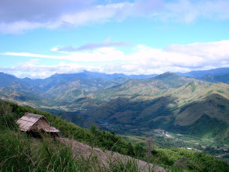
Tanay is a first class municipality in the province of Rizal, Philippines. It is located 57 kilometers (35 mi) east of Manila. It contains portions of the Sierra Madre Mountains and is bordered by Antipolo City in the northwest, Baras, Morong and Teresa in the west, General Nakar (Quezon Province) in the east, and Pililla, Santa Maria (Laguna province) as well as the lake Laguna de Bay in the south.
The majority of the population consists of Tagalogs who live near Laguna de Bay, though there is also a significant percentage of mountain dwelling people living in the northern portions of the municipality. The town's major trades consist of fishing, agriculture and regional commerce.
Tanay is also believed to be the birthplace of the Sambal language.
History
Tanay was settled by early Austronesian people. Shortly after the conquest and subjugation of Manila by the Spaniards and the surrounding lake areas by Juan de Salcedo in 1570-1574, Franciscan missionaries arrived to Christianize the inhabitants of what is now the Morong-Pililla area. In 1583, both Morong and Pililla were created as separate towns with Tanay forming part of Pililla.
Tanay was founded as a separate Pueblo (town) in 1606 under the name "Monte de Tan-ay". In 1620, the administration was moved to San Antonio (now called Inalsan or Pantay) and Tandang Kutyo. In 1638, the town was burned during an uprising of Chinese living in the area, and the town was rebuilt in 1640 at the present day location.
In 1747, the town of Tanay consisted of only eight barangays, namely Nuestra Senora del Rosario, Sa Josep, San Ildefonso de Tanay, San Francisco de Maytubig, San Pedro de Alcantara, San Lucas y San Antonio, San Apostol and San Agustin de Balugbog.
In 1853, a new political subdivision was formed. The town of Tanay together with Morong, Baras, Pililla, Angono, Binangonan and Jalajala from the Province of La Laguna, with the capital at Morong. This district was later changed to Distrito Politico-Militar de Morong after four years.
Tanay became a Municipality in 1894 as an effect of the Spanish Maura Law. The first election of Public Office took place in 1895-1898 and 1898-1900 under the Revolutionary Government of the Philippines.
Tanay members of the Katipunan fought valiantly during the Revolution against Spain. The town was the headquarters of the second military area of the Philippine Revolutionary Government under General Emilio Aguinaldo. And for a brief period between 1899 and 1900, Tanay served as the capital of the then Morong Province after the Philippine-American War broke out and the American forces invaded the lake towns and captured Antipolo.
In 1900-1901, Tanay as was under the Government appointed by the American Military under Taft Commission. From 1903-1934 the town leadership was under the American Rule then in 1934 Tanay was under the Commonwealth of the Philippines as the Tydings-McDuffie Act was approved on March 24, 1934 until the Philippines fell to the hands of the Japanese during the Second World War in 1942.
In 1942-1945 the Mountains of Tanay served as the Guerrilla base for 'Marking's Fil-American Guerrillas, beginning the Liberation of Tanay on March, 1945 a very decorated by the Filipino soldiers of the 41st and 42nd Division of the Philippine Commonwealth Army, 4th Regiment of the Philippine Constabulary and the recognized guerrillas against the Japanese occupation forces during World War II. Gen. Agustin Marking is buried in a private cemetery by the road overlooking his son's farm in Sampaloc.
In October 2003, deposed Philippine president Joseph Estrada was transferred to a rest home in Sampaloc, a mountain barangay. He remained under house arrest until he was given executive clemency by President Gloria Macapagal-Arroyo.
During the Typhoon Ketsana (Ondoy) on September 26, 2009. Tanay was one hardest hit due to the rising of Laguna Lake and the flooding of Tanay River.
Places of interest
- Calinawan Cave and Rawang Pass: Stronghold of the Filipinos in the Revolution against Spain and in the Filipino-American War in April–May 1900. It also housed the townspeople during the Second World War, beginning the Invasion of Tanay in March, 1945 from the Filipino soldiers and recognized guerrillas against the Japanese Imperial forces.
- Daranak Falls and Batlag Falls: A popular local tourist attraction.
- Masungi Rock in the Sierra Madre mountains near Cuyambay, may be of interest to hikers and geologists.
- Parola, the historic lighthouse of Tanay, offers a picturesque view of Laguna de Bay as well as several nearby restaurants.
- Tanay Catholic Church: Also known as San Ildefonso Parish Church, it was built between 1773-1783 using forced labor, and is the second oldest church in the province.
- Tanay Coliseum, near the Municipal Hall, features cockfights and local boxing matches.
- Tanay Plaza and T.Q. Bernados Park: Adjacent to the church, this is the main social gathering place in the town, where during festivals one may observe the performances of the Tariki dance, or the Subok. A monument of Jose Rizal also stood there.
- "Tanay Town Center (SaveMore)": The First Community Mall ever established at Tanay, showing the start of business development in the area.
- "George Town": A nightclub for those who want to have enjoyment in their life.
- "Jollibee": the first fast food in the town
- "Regina Rica": A 71-foot-tall statue of the Queen of the Holy Rosary.
- "Tanay Adventure Camp", at Sitio Malaanonang, Tanay, Rizal, 1 km from the University of Rizal System, holds the record for having the longest zip line (230m) in Rizal.
- "Daraitan: a barangay accessible through a one-hour trip from the town. Its famous attraction is the clean Daraitan River.
Accommodations
- Loreland Farm Resort
Location: Sitio Loreland, Barangay San Roque, Antipolo City, Antipolo / Rizal, Manila, Philippines
- Seven Suites Hotel Observatory
Location: Hollywood Hills Sumulong Highway, Antipolo / Rizal, Manila, Philippines
- Thunderbird Resorts - Rizal
Location: Eastridge Avenue, Binangonan, Antipolo / Rizal, Manila, Philippines
- Villa Jhoana Resort
Location: Ibanez St., Angono, Rizal, Antipolo / Rizal, Manila, Philippines
How to get there
- The province of Rizal is 110 kilometers south of Manila. It is accessible by land transportation from Metro Manila and the neighboring provinces of Southern Tagalog and Central Luzon.
- Buses, varied public utility vehicles, and the metro rail system with stations at Crossing/EDSA in Mandaluyong City, Robinson’s Galleria in Ortigas Avenue, Quezon City and Farmer’s Market in Cubao, Quezon City ply the routes to Antipolo, Taytay, Cainta, Binangonan, Angono, Tanay and other towns in Rizal.
- In touring around the town or from one city to another city, jeepneys and tricycles are available as a mode of transportation.