


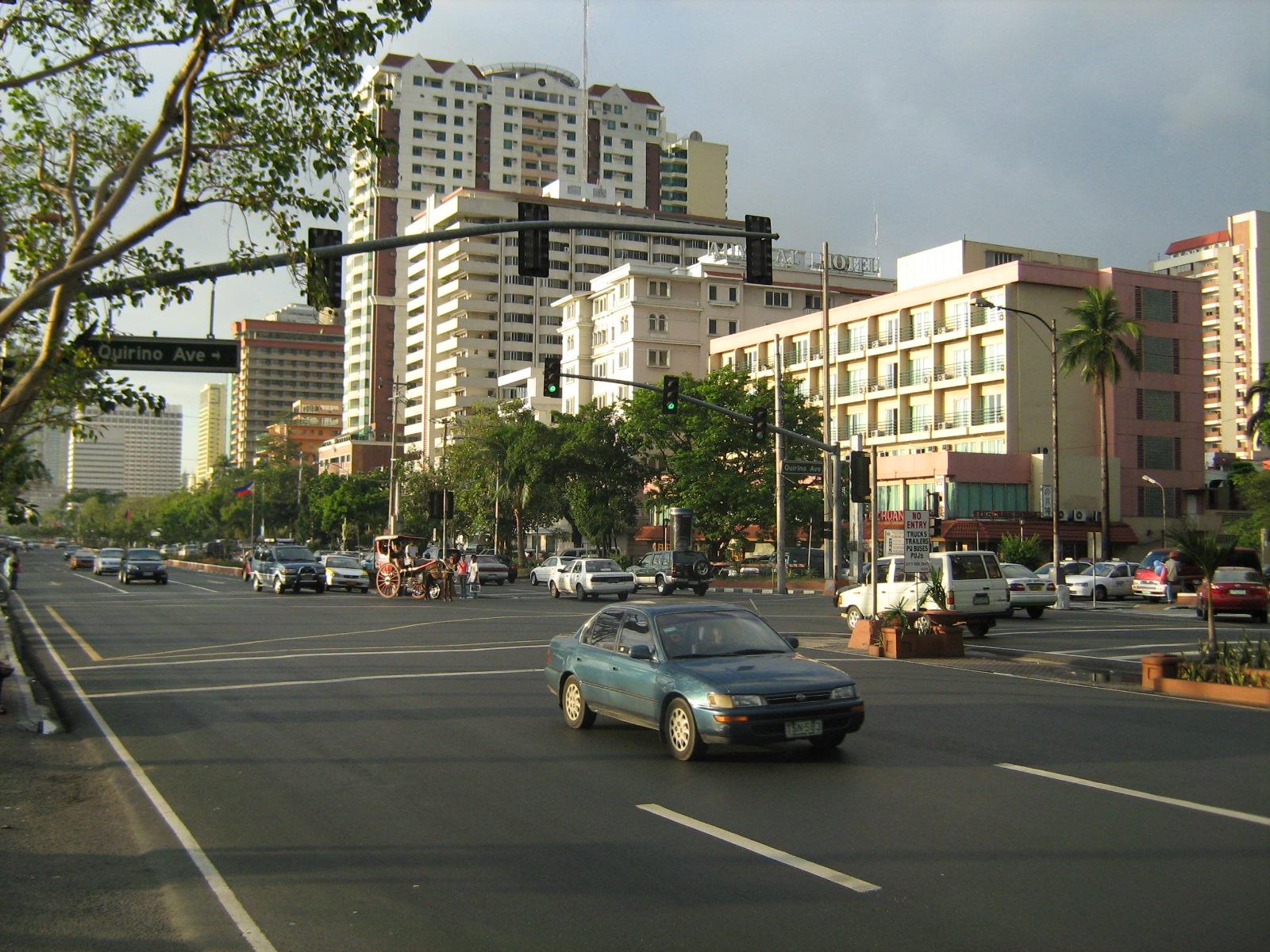
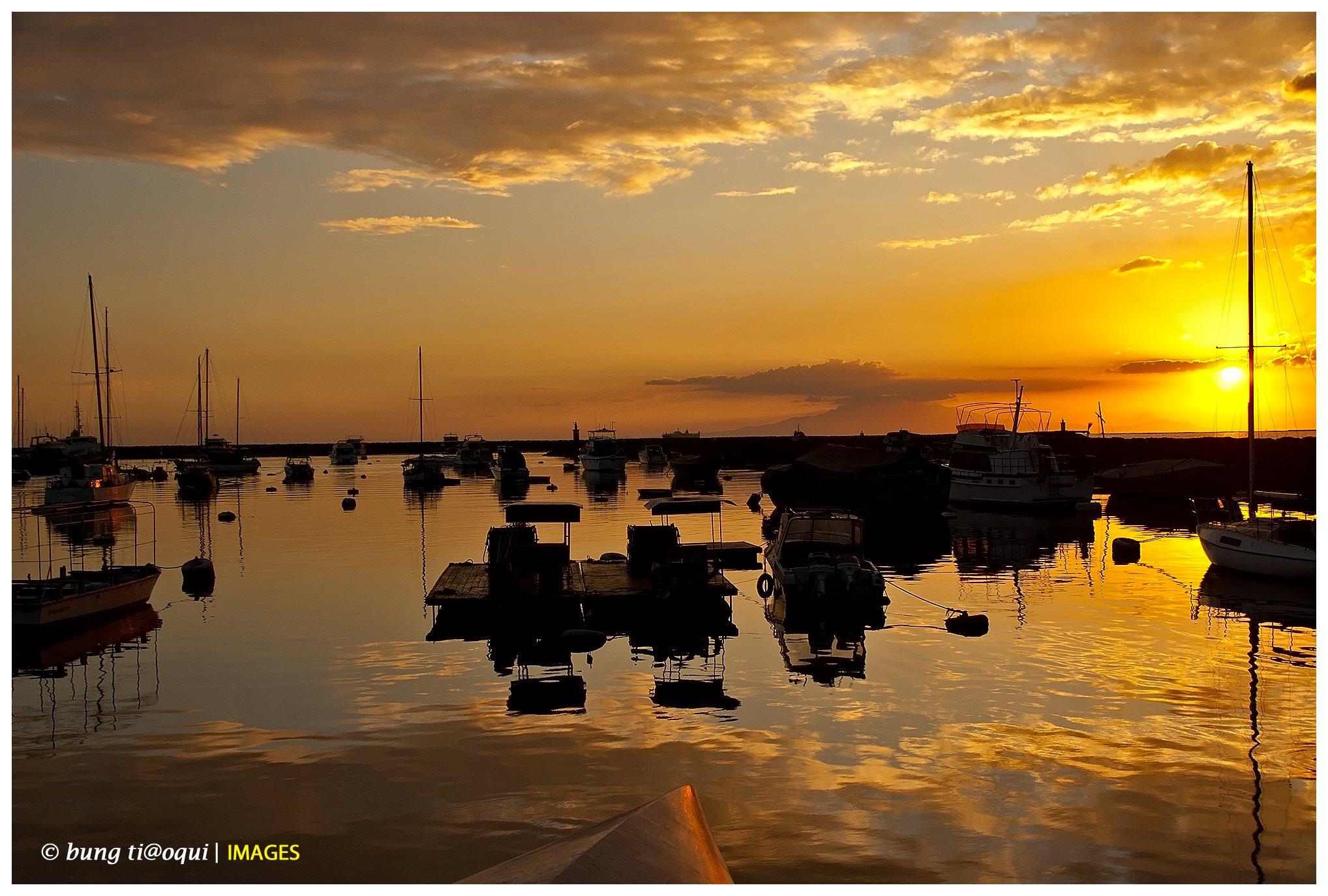
Roxas Boulevard, formerly known as Dewey Boulevard, is a boulevard in Metro Manila in the Philippines. The boulevard, which runs along the shores of Manila Bay, is well known for its spectacular sunsets and stretch of coconut trees. The divided roadway has become a trademark of Philippine tourism, famed for its yacht club, hotels, restaurants, commercial buildings and parks. Originally called Cavite Boulevard, it was renamed Dewey Boulevard in honor of the American Admiral George Dewey, who under his command defeated the Spanish Navy in the Battle of Manila Bay in 1898. The boulevard was again renamed to Roxas Boulevard in the 1960s to honor President Manuel Roxas, the fifth president of the Republic of Philippines.
Roxas Boulevard, Malate, Manila
The boulevard is also an eight-lane major arterial road designated as Radial Road 1 that connects the center of Manila with Pasay City and Parañaque City. The arcing road runs in a north-south direction from Luneta in Manila and ends in Parañaque City, at the intersection of Ninoy Aquino International Airport Road or NAIA Rd. Beyond its southern terminus, starts the Manila-Cavite Expressway, also known as the Coastal Road.
History
City Beautiful movement
The Cavite Boulevard was part of architect Daniel Burnham's plan for beautifying the city of Manila. At the request of Commissioner William Cameron Forbes, Burnham visited the country in 1905 at the height of the City Beautiful movement, a trend in the early 1900s in America for making cities beautiful along scientific lines, for the future urban development of Manila and Baguio City.
Original concept
According to Burnham's original concept of the Cavite Boulevard, the Bayfront from the Luneta southward should be a continuous parkway, extending in the course of time all the way to the Cavite Navy Yard about 20 miles (32 km) away. This boulevard, about 250 ft (76 m) in width, with roadways, tramways, bridle path, rich plantations, and broad sidewalks, should be available for all classes of people in all sorts of conveyances, and so well shaded by coconut palms, bamboo, and mangoes as to furnish protection from the elements at all times.
In order to make the boulevard presentable and useful as soon as possible, a quick-growing tree like the acacia might be planted, alternating with the trees of slower growth, and be replaced after the latter retain their growth. The boulevard's seaward side should be planted so as to interrupt occasionally the view of the sea and, by thus adding somewhat of a mystery, enhance the value of the stretch of ocean and sky. The boulevard would be on reclaimed land for about as far south as the Old Fort San Antonio Abad in Malate, beyond which it strikes the beach and follows the shoreline to Cavite. The possible extension of the ocean boulevard along the north shore would naturally depend upon the development of the town in that direction and upon the question of additional harbor works north of the Pasig River.
Points of interests
Parks
- Rizal Park
CCP Complex
Cultural Center of the Philippines performing and entertainment complex
- Cultural Center of the Philippines
- Folk Arts Theater
- Manila Film Center
- Star City, Manila
- ASEAN Garden
- Boom na Boom
Convention and trade center
- The Philippine International Convention Center.
- Philippine International Convention Center (CCP complex)
- World Trade Center Metro Manila (CCP complex)
Government buildings
- The Bangko Sentral ng Pilipinas along Roxas Boulevard
- Bangko Sentral ng Pilipinas (Central Bank of the Philippines)
- Department of Foreign Affairs
- Department of Finance
- Philippine Navy
- Senate of the Philippines (GSIS Building)
- Office of the Vice President of the Philippines (Coconut Palace)
Foreign embassies
- The US Embassy in Manila.
- Embassy of the United States in Manila
- Embassy of Japan in Manila
Museums
- The Metropolitan Museum of Manila at the Central Bank complex between Aldecoa St. and Pablo Ocampo St. (Vito Cruz St.)
- Metropolitan Museum of Manila (Central Bank of the Philippines Complex)
- Museo Pambata (the old Manila Elks Club)
- Bangko Sentral ng Pilipinas Money Museum (Central Bank of the Philippines Complex)
Hotels
- Manila Hotel
- Diamond Hotel
- Sofitel Plaza Hotel (CCP complex)
- Heritage Hotel Manila
- Midas Hotel & Casino (formerly the Hyatt Regency Manila)
Yacht club
- Manila Yacht Club
Intersections
This is a list of intersections from north to south, along with major landmarks found on either side of the street at the south of the specified intersection. Bold names are road crossings with traffic lights. Names in italics indicate former names, some of which are still in wide use. Designations in square brackets indicate official Metro Manila national roads.
Ermita, Manila
- Padre Burgos Ave. [C-1 & R-7]: Rizal Park and Rizal Monument
- Kalaw Avenue [R-7]: Museo Pambata (west)
- United Nations Ave.
- Flores St.: Embassy of the United States in Manila (west)
- Arquiza St.
- Padre Faura St.
- Sta. Monica St.
- Salas St.
- Cuarteles St.
Malate, Manila
- Pedro Gil St. (Herran Street) [R-4]
- Quintos St.
- Pasaje del Carmen St.
- Remedios St. (Pedestrian Crossing)
- San Andres St [C-2].
- Corta Bitarte St.
- Quirino Avenue: Ospital ng Maynila Medical Center (east)
- Aldecoa St.: Metropolitan Museum of Manila and Department of Finance (east), Philippine Navy Headquarters (west)
- Pedro Bukaneg Drive in the CCP Complex/Pablo Ocampo St. (Vito Cruz Street)
Pasay
- Vicente Sotto St.: CCP complex
- Maytubig St.
- R. Layug St.
- E. Rodriguez St.
- Lourdes St.
- Dapitan St.
- San Juan St.
- Perla St.
- Buendia Flyover — Gil Puyat Avenue (Buendia Avenue) [C-3]
- Sta. Monica St.
- Villaruel St.
- San Luis St.
- Sta. Escolastica St.
- Williams St.: Department of Foreign Affairs (east)
- Arnaiz Avenue (Libertad Street) [C-3]
- Derham St.: Cuneta Astrodome (east)
- Don B. Hernandez St.: Embassy of Japan in Manila (east)
- EDSA Flyover — Epifanio de los Santos Avenue (Highway 54)[C-4]: SM Mall Of Asia (west)
- Cuneta Ave.
- Ortigas St.
- Russel Ave.
Parañaque
- Guarra St.
- Bayanihan St.
- Redemptorist Road: National Shrine of Our Mother of Perpetual Help (east), Baclaran Mosque (west)
- Opeña St.
- Airport Rd.
- Tomas Claudio St.
- T. Alonzo St.
- Jose Abad Santos St.
- Bayview Drive
- NAIA Rd. (MIA Road)